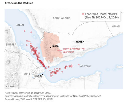
Russia Reportedly Supplied GEOINT Data For Houthi Assaults On Western Ships In Maritime Chokepoint In the Middle East, Russian intelligence officials have allegedly provided Iran-backed Houthi rebels with geospatial intelligence (GEOINT) data for strategic planning and operational decision-making to attack Western vessels in the critical maritime chokepoint of the southern Red Sea. According to The Wall Street Journal report: The Houthis, which began their attacks late last year over the Gaza war, eventually began using Russian satellite data as they expanded their strikes, said a person familiar with the matter and two European defense officials. The data was passed through members of Iran’s Islamic Revolutionary… — Continue at ZeroHedge News : Read More
Home » Russia Reportedly Supplied GEOINT Data For Houthi Assaults On Western Ships In Maritime Chokepoint – Tyler Durden
Russia Reportedly Supplied GEOINT Data For Houthi Assaults On Western Ships In Maritime Chokepoint – Tyler Durden
